The Coulonge River Route
|
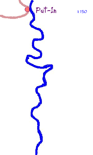 |
Put in near an abandoned lumber camp at K150 on the
river. If you arrive after dark (not recommended) there's a serviceable
campsite here. Otherwise, a short paddle offers a variety of open and
sandy sites.
Slow water. Lots of meanders, sandy banks and bluffs, for the next 15k. One of the best stretches for big animal sightings. |
| A decent coldwater spring on the right bank at K127. | |
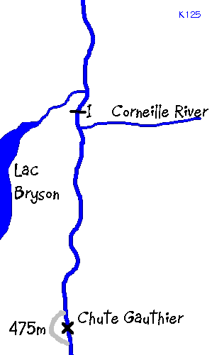 |
The river gathers speed as it approaches the
confluence with the Corneille. Swifts and shallow Class I's for a few K.
The campsite at the confluence is one of the best on the river.
Shallow swifts, on and off, for several K. |
| A brief French lesson: Chutes means Falls. Exercise
caution accordingly. Gauthier is a double set of falls with some tricky
stuff in between. The bottom falls are particularly impressive.
| |
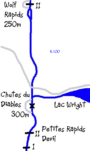 |
Wolf Rapids are a straightforward centre run. |
| Paddle slowly up to Chutes du Diable, stretch your legs,
and enjoy the view! Many artifacts from the logging days ... a massive
deflection wall with tonsof wood debris behind it, iron
spikes and rings anchored in rock for the booms. Petites Rapides Devil is short and fairly straightforward. Keep your line (right side) and watch for that last boulder and accompanying haystack. | |
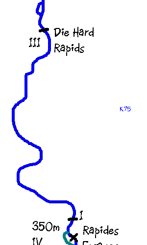 |
The first section (Class III) of Die Hard rapids can be lined on the right. The bottom section is Class II -- ferry to centre and enjoy the big waves. |
| When the water's high enough, as it was in
'98, there's a great set of Class II rapids just below Rapides Enrages
with ledges, haystacks, holes, and eddies -- everything you need for a few
hours of fun while honing your skills. A bit of a rock garden at low
water -- just shoot it on the left bank
Excellent coldwater spring near the far end of the portage
trail. | |
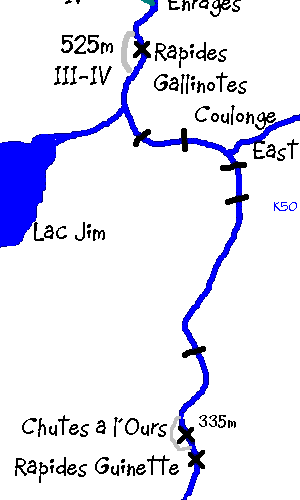 |
Rapide Gallinotes has a set of falls at both the top and
the bottom. The Class I between them can be safely run or lined.
|
| A nice Class II roller coaster upstream of Chutes a
L'Ours. Nice campsite at Chutes a l'Ours (Bear Falls). Rapides Guinette is a complex, kilometer long set of
rapids which can be lined or run in any combination that suits your skills
and temperament. Allegedly, there's a long portage on the left bank
-- might be necessary in high water. Great campsite about halfway
down. | |
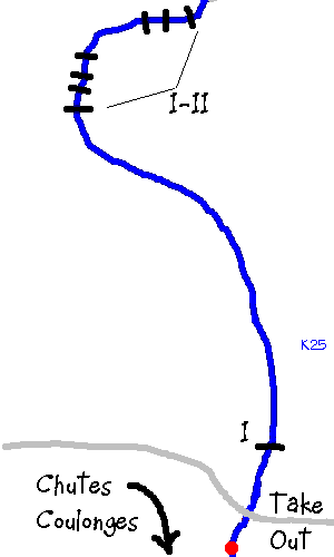 |
After Guinette, theres a long run of Class I's
and II's which, alone, are worth the price of admission. Great fun, and
fastwater for the next 15k.
|
| The take-out is just below the Terry Fox bridge, a few K above the falls (Chutes Coulonge). Hap Wilson's book suggests taking out at the falls -- no longer feasible since they reopened the tourist encampment there and floated booms several hundred meters upriver. They charge a $5 fee just to get a view of the falls. Is it worth it? Well, I'd hate to have walked away from the Coulonge without seeing her final, 50 meter plunge down to the Ottawa River Valley. |
Disclaimer: This map is a rough hand-made sketch -- I make no claims to accuracy, scale, etc., and I would not recommend running this river without the aid of REAL maps and/or detailed route descriptions such as those referred to on the RESOURCES page of this site
.
- J.P.